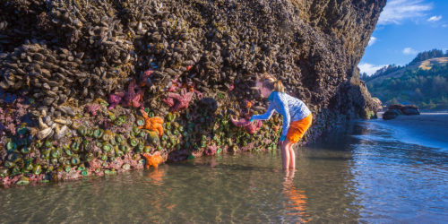
PORT ORFORD — No Oregon coastal community may be as inextricably tied to the sea as Port Orford. Built in the lee of a great headland, framed north and south by two others, Oregon’s westernmost town is a 19th century logging and fishing port whose rich heritage is focused heavily upon the view from its windows.
The town of 1,200 dates its history to June 1851, when steamboat Capt.
William Tichenor landed nine men to establish a settlement on tribal land. The local Tututnis didn’t take kindly to the incursion. Though armed with rifles and a small cannon, the landing party was forced to retreat to a craggy tidal island known today as Battle Rock. When the confrontation turned deadly, the settlers escaped to the north under cover of night.
A month later, Tichenor returned with a better-armed party of 70 men and dispatched the Tututnis. Within five years, the tribe had been marched 125 miles north to the Siletz reservation, where descendants remain today. But Battle Rock is protected as a monument to their tenacity.
Beside the parking lot at Battle Rock Wayside Park, outside the Chamber of Commerce visitor center, a set of interpretive plaques tell stories of Port Orford’s human and natural history.
Supporters of the Redfish Rocks Marine Reserve, established just offshore by the state in 2009, are hopeful that the visitor center might be expanded to incorporate displays that “bring the marine reserve to land. We want to display deep-water creatures on shore,” explained Tyson Rasor, project coordinator for the Redfish Rocks Community Team.
The 2½-square-mile reserve, between Bandon and Gold Beach, begins at the point of the lowest low tide of the year, extending straight to sea through a half-dozen prominent sea stacks.
To read the entire story on RegisterGuard.com, click here.
Story and photo by John Gottberg Anderson for The Register-Guard


